


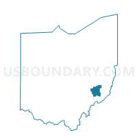
CALDWELL III Voting District, Noble County, Ohio
About
Outline

Summary
| Unique Area Identifier | 650827 |
| Name | CALDWELL III Voting District |
| County | Noble County |
| State | Ohio |
| Area (square miles) | 0.13 |
| Land Area (square miles) | 0.12 |
| Water Area (square miles) | 0.01 |
| % of Land Area | 95.77 |
| % of Water Area | 4.23 |
| Latitude of the Internal Point | 39.74614420 |
| Longtitude of the Internal Point | -81.51480460 |
Maps


Graphs
Select a template below for downloading or customizing gragh for CALDWELL III Voting District, Noble County, Ohio


Neighbors
Neighoring Voting District (by Name) Neighboring Voting District on the Map
- CALDWELL I Voting District, Noble County, OH
- CALDWELL IV Voting District, Noble County, OH
- MAPLE HEIGHTS Voting District, Noble County, OH
- OLIVE Voting District, Noble County, OH